| News / World News |
The Atlantic Hurricane Season
Atmospheric Science, Earth, Animation
The Atlantic hurricane season is the period in a year when hurricanes usually form in the Atlantic Ocean. In the Northern Atlantic Ocean, a distinct hurricane season occurs from June 1 to November 30, sharply peaking from late August through September.
NASA has a unique and important view of hurricanes around the planet. Satellites and aircraft watch as storms form, travel across the ocean and sometimes, make landfall. After the hurricanes have passed, the satellites and aircraft see the aftermath of hurricanes, from downed forests to mass power loss.
In 2018, Hurricanes Florence and Michael made catastrophic landfalls over the United States. They caused extreme flooding, record-breaking winds, and storm surges that devastated communities.
Understanding how hurricanes behave is critical to saving lives. How a hurricane forms, develops and dissipates is a complex problem though; it involves many different processes that are highly interconnected. But from space and the air, NASA satellites and aircraft can break down the underlying physics by monitoring each component of a hurricane. There are key ingredients for hurricanes to form.
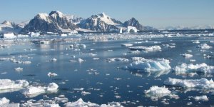
First, we need warm waters that provide fuel for the storms. Water evaporates from the warm ocean and creates humid air, which then rises and cools to form clouds and rain. 3D structures to look for inside storms are long rain bands and a near-circular eyewall.
The warmer the ocean, the stronger the storm can be, which often means heavy rainfall and extreme winds. Understanding each component is just part of the puzzle. The key is to figure out how they fit together and to do this, scientists step into the digital world.
This is a computer-generated model of a hurricane. Inside this digital environment, the atmosphere is programmed to behave as much as possible like the real world, governed by the laws of physics. What makes this a valuable research tool is that scientists can put satellite observations into this digital world to see how the entire system evolves.
The impact of a hurricane lasts long after the storm has dissipated. Satellites and aircraft can also be used to monitor damage and recovery.
In 2017, Hurricane Maria caused the longest electric power blackout in U.S. history in Puerto Rico. Over the following year, satellite data helped first responders monitor where and when power was restored.
And after Hurricane Maria, aircraft were used to map the country’s recovering forests. Satellites, aircraft, and computer models help us understand each stage of a hurricane including the aftermath. As we learn more, not only will other agencies better forecast weather, but communities will have more time to prepare and evacuate from potentially dangerous storms.
Credit: NASA's Goddard Space Flight Center
Music credits: “Northern Breeze” by Denis Levaillant [SACEM], “Stunning Horizon” by Maxime Lebidois [SACEM], Ronan Maillard [SACEM], “Magnetic Force” by JC Lemay [SACEM] from Killer Tracks
Lead Producer: Joy Ng (USRA)
Producer: Ryan Fitzgibbons (USRA)
Scientists: Scott Braun (NASA/GSFC), George Huffman (NASA/GSFC), Dalia B Kirschbaum (NASA/GSFC)
Narrator: LK Ward (USRA)
Support: Kathryn Mersmann (USRA)
Country of origin: United States
Language: English
Released on: June 3, 2019
YOU MAY ALSO LIKE