| News / Science News |
West Antarctic Glacier loss appears unstoppable
NASA | MAY 14, 2014
A new study by researchers at NASA and the University of California, Irvine, finds a rapidly melting section of the West Antarctic Ice Sheet appears to be in an irreversible state of decline, with nothing to stop the glaciers in this area from melting into the sea.

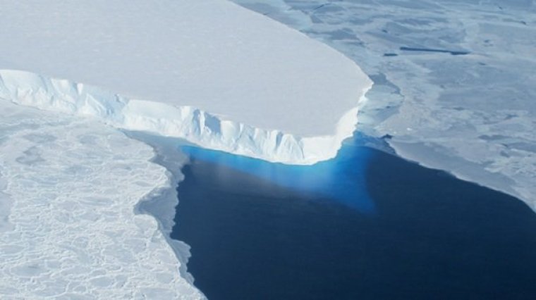
Thwaites Glacier. Image credit: NASA
The study presents multiple lines of evidence, incorporating 40 years of observations that indicate the glaciers in the Amundsen Sea sector of West Antarctica "have passed the point of no return," according to glaciologist and lead author Eric Rignot, of UC Irvine and NASA's Jet Propulsion Laboratory in Pasadena, California.
These glaciers already contribute significantly to sea level rise, releasing almost as much ice into the ocean annually as the entire Greenland Ice Sheet. They contain enough ice to raise global sea level by 4 feet (1.2 meters) and are melting faster than most scientists had expected.
Rignot said these findings will require an upward revision to current predictions of sea level rise.
The glaciers flow out from land to the ocean, with their leading edges afloat on the seawater.
The point on a glacier where it first loses contact with land is called the grounding line. Nearly all glacier melt occurs on the underside of the glacier beyond the grounding line, on the section floating on seawater.
Just as a grounded boat can float again on shallow water if it is made lighter, a glacier can float over an area where it used to be grounded if it becomes lighter, which it does by melting or by the thinning effects of the glacier stretching out.
The Antarctic glaciers studied by Rignot's group have thinned so much they are now floating above places where they used to sit solidly on land, which means their grounding lines are retreating inland.
"The grounding line is buried under a thousand or more meters of ice, so it is incredibly challenging for a human observer on the ice sheet surface to figure out exactly where the transition is," Rignot said. "This analysis is best done using satellite techniques."
YOU MAY ALSO LIKE


